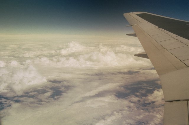
 Some
pretty clouds (towering cumulus) in the Tasman Sea, taken from
the Wellington-Sydney flight.
Some
pretty clouds (towering cumulus) in the Tasman Sea, taken from
the Wellington-Sydney flight. by Trevor McGavin.
Here's a selection of photos taken on a holiday to Aussie with my brother (Peter) in November 1999. It included a long drive from Perth to Adelaide, across the Nullarbor Plain. We allowed just under 2 weeks to get from Perth to Adelaide with the plan being to stick near the coast most of the way. By the time we returned the rental car (a trusty Toyota Camry) to "Hertz" in Adelaide we had covered around 5400km!
All photos were taken with my trusty old Pentax ME-Super 35mm reflex with 35-80mm lens. A polarizing filter was used to enhance any cloud/sky scenes. The negatives were scanned into digital format using an Epson Filmscan 200.
I took about 5 hours of Hi8 video on the trip as well - managed one or two reasonable lightning shots, and some good sound effects with Aussie flies landing on the microphone! One day I might digitise the best bits (need lots of time for that though).
Click the images to see higher resolution versions.
Some
pretty clouds (towering cumulus) in the Tasman Sea, taken from
the Wellington-Sydney flight.
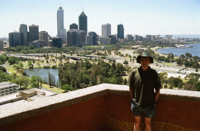 Made
it to Perth - the easy way; flew from Sydney, a four and a half
hour flight. Clear skies and 32C!
Made
it to Perth - the easy way; flew from Sydney, a four and a half
hour flight. Clear skies and 32C!
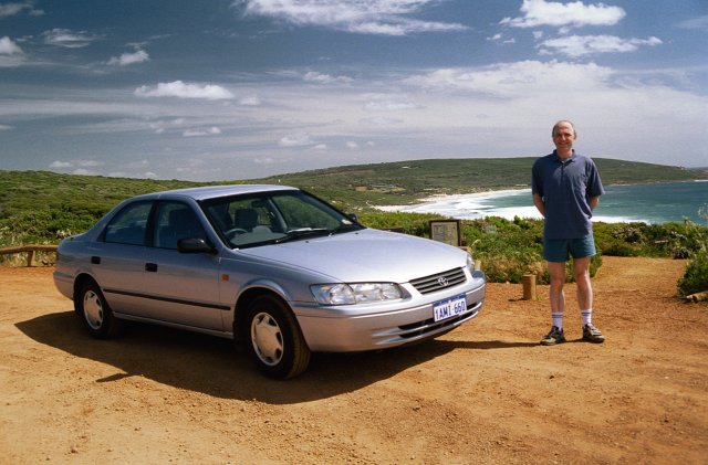 Near the western-most point of the holiday - Yallingup, about
300km south-southwest of Perth. Interestingly a large number of
localities in WA seemed to have names ending in the syllable
"up" (eg. Nannup, Beedelup, Normalup, etc.)
Near the western-most point of the holiday - Yallingup, about
300km south-southwest of Perth. Interestingly a large number of
localities in WA seemed to have names ending in the syllable
"up" (eg. Nannup, Beedelup, Normalup, etc.)
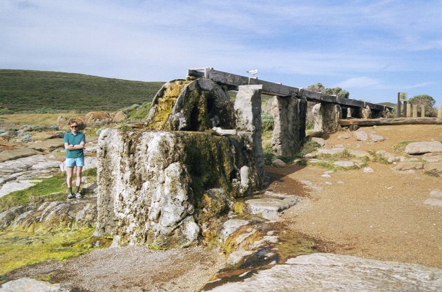 An unusual "petrified" waterwheel at Cape Leeuwin
(Australia's most "south-western" point - near Augusta,
WA). The waterwheel was used to generate power for the lighthouse
at the Cape in the 1800's.
An unusual "petrified" waterwheel at Cape Leeuwin
(Australia's most "south-western" point - near Augusta,
WA). The waterwheel was used to generate power for the lighthouse
at the Cape in the 1800's.
 A railway museum in the forestry town of
Pemberton (between Augusta and Albany, WA). Sadly, the steam
trains weren't running at this time of year (because of the fire
danger) but we did get a pleasant bush-tram ride.
A railway museum in the forestry town of
Pemberton (between Augusta and Albany, WA). Sadly, the steam
trains weren't running at this time of year (because of the fire
danger) but we did get a pleasant bush-tram ride.
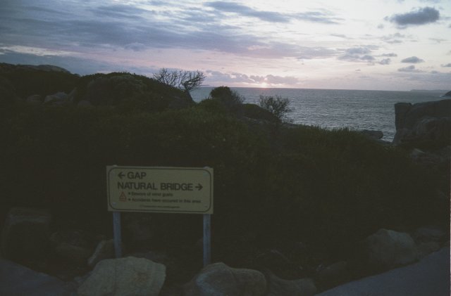 Sunset near Albany, in Torndirrup National Park, WA. Some
interesting blowholes and coastal rock formations here.
Sunset near Albany, in Torndirrup National Park, WA. Some
interesting blowholes and coastal rock formations here.
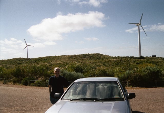 Wind generators near Esperance, WA. There were 9 of this size,
each capable of generating 225 kW, and altogether supply up to
14% of Esperance's power. It was very windy that day too, so they
seemed most appropriate!
Wind generators near Esperance, WA. There were 9 of this size,
each capable of generating 225 kW, and altogether supply up to
14% of Esperance's power. It was very windy that day too, so they
seemed most appropriate!
 A surfing beach near Esperance, WA.
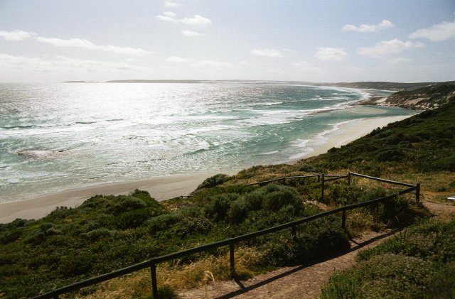
 More nice coastal scenery near Esperance, WA.
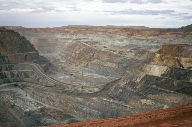 Inland now to Kalgoorlie. This is the "Superpit", the
largest operating open-cast goldmine in Australia - 4km long and
up to 2km wide in places, the size of a small town! A daily event
around 5pm each day is a dynamite blast which tourists can watch
- we were lucky enough to see this by chance when we arrived -
but without knowing it was going to happen, so didn't have
cameras ready in time! We visited a "tourist"
underground goldmine near Kalgoorlie as well (taken 120 feet down
below in a small elevator shaft) but sadly came back empty-handed
(in terms of gold)!
Inland now to Kalgoorlie. This is the "Superpit", the
largest operating open-cast goldmine in Australia - 4km long and
up to 2km wide in places, the size of a small town! A daily event
around 5pm each day is a dynamite blast which tourists can watch
- we were lucky enough to see this by chance when we arrived -
but without knowing it was going to happen, so didn't have
cameras ready in time! We visited a "tourist"
underground goldmine near Kalgoorlie as well (taken 120 feet down
below in a small elevator shaft) but sadly came back empty-handed
(in terms of gold)!
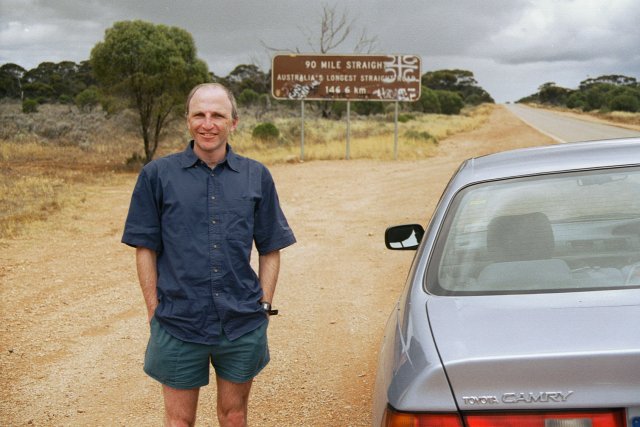 Onto the Nullarbor now. This shows the beginning (western end) of
Australia's longest straight section of road, 90 miles (or
146.6km), shortly after passing through the small locality of
Balladonia. The road is good all the way; just prior to this we
were able to pass two "wide-load" trucks (one carrying
a house) travelling in the same direction as us (at about
80km/hr). Every so often we came across designated sections of
road marked as emergency aircraft landing strips. These had what
looked like pedestrian crossings on them - maybe for kangaroos to
use?!
Onto the Nullarbor now. This shows the beginning (western end) of
Australia's longest straight section of road, 90 miles (or
146.6km), shortly after passing through the small locality of
Balladonia. The road is good all the way; just prior to this we
were able to pass two "wide-load" trucks (one carrying
a house) travelling in the same direction as us (at about
80km/hr). Every so often we came across designated sections of
road marked as emergency aircraft landing strips. These had what
looked like pedestrian crossings on them - maybe for kangaroos to
use?!
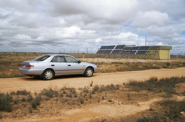 In the Nullarbor every 1 or 2 hundred kilometres or so we saw
these solar powered stations off to the side of the main road
(apparently owned by Telecom).
In the Nullarbor every 1 or 2 hundred kilometres or so we saw
these solar powered stations off to the side of the main road
(apparently owned by Telecom).
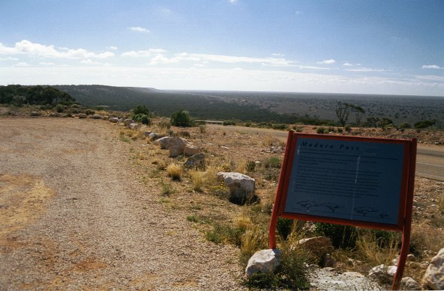 It's a myth - the Nullarbor Plain isn't flat! We were surprised
when we arrived at the Madura Pass where the road drops a few
hundred feet down an escarpment cut be sea-waves a long time ago.
It's a myth - the Nullarbor Plain isn't flat! We were surprised
when we arrived at the Madura Pass where the road drops a few
hundred feet down an escarpment cut be sea-waves a long time ago.
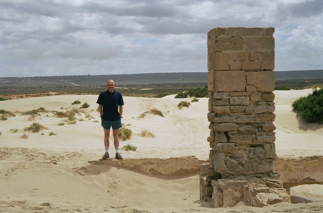 Here are the remains of Eucla's Telegraph station in the
Nullarbor, near the Western Australia - South Australia border.
Today Eucla is located at the top of the escarpment, in the
background of this picture.
Here are the remains of Eucla's Telegraph station in the
Nullarbor, near the Western Australia - South Australia border.
Today Eucla is located at the top of the escarpment, in the
background of this picture.
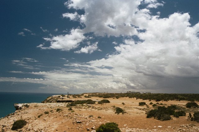
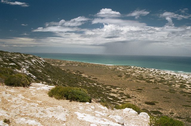 Into South Australia now and the beginning of the most scenic
part of the Nullarbor. The road goes near the sea for about 150km
between Border Village and Nullarbor Roadhouse, and there are a
number of nice viewing points along the way. There were some
interesting cumuliform showers around that day too.
Into South Australia now and the beginning of the most scenic
part of the Nullarbor. The road goes near the sea for about 150km
between Border Village and Nullarbor Roadhouse, and there are a
number of nice viewing points along the way. There were some
interesting cumuliform showers around that day too.
Each viewing point is marked by a "P" on the main road, the same symbol used in Aussie cities to mark parking, where they are just about all "Wilsons Parking". We wondered if Mr Wilson also owned parking on the Nullarbor! (at least parking was free here).
 Another coastal view on the Nullarbor. Interesting shower cloud
in background.
Another coastal view on the Nullarbor. Interesting shower cloud
in background.
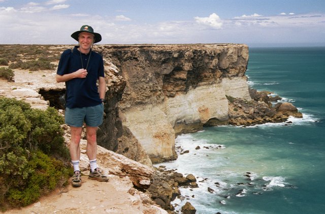
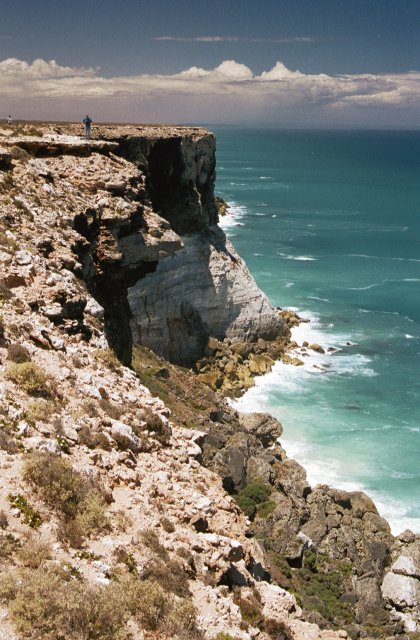 Where the Nullarbor meets the sea - very spectacular cliffs!
There are warning signs at the stopping points about the dangers
of killing yourself - you can walk right to the edge without any
fences!
Where the Nullarbor meets the sea - very spectacular cliffs!
There are warning signs at the stopping points about the dangers
of killing yourself - you can walk right to the edge without any
fences!
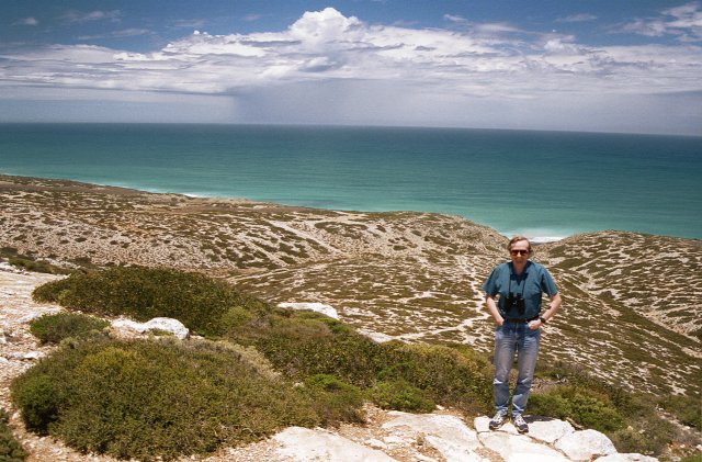
 We
happened to follow an unstable weather system across the
Nullarbor (as you may have noticed from earlier pictures) which
made the clouds impressive as well. Another viewing point on the
coastal part of the Nullarbor.
We
happened to follow an unstable weather system across the
Nullarbor (as you may have noticed from earlier pictures) which
made the clouds impressive as well. Another viewing point on the
coastal part of the Nullarbor.
 By the Nullarbor cliffs.
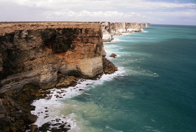 More Nullarbor cliffs - they looked like they went on to infinity
(and beyond) at this point.
More Nullarbor cliffs - they looked like they went on to infinity
(and beyond) at this point.
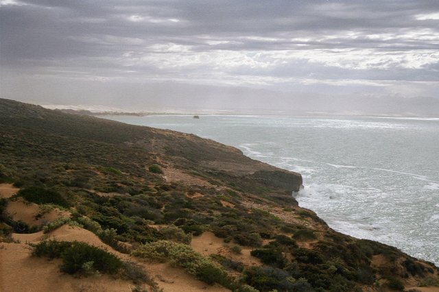 This is the "Head of Bight" (northern most point of the
Australian Bight), coastal scenery just east of Nullarbor
Roadhouse.
This is the "Head of Bight" (northern most point of the
Australian Bight), coastal scenery just east of Nullarbor
Roadhouse.
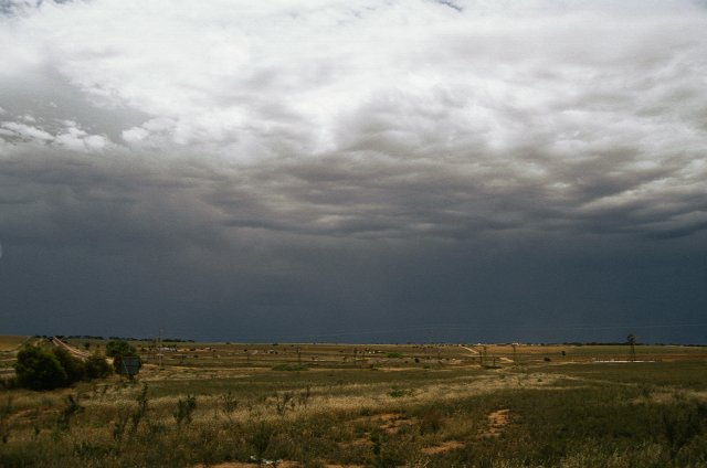 Storm activity near Penong in South Australia. Starting to get
back into civilisation again as we head east into the wheat-belt.
There are numerous agricultural-type windmills in this scene but
they're hard to see.
Storm activity near Penong in South Australia. Starting to get
back into civilisation again as we head east into the wheat-belt.
There are numerous agricultural-type windmills in this scene but
they're hard to see.
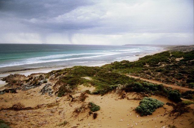 Rain streaks at Back Beach, a popular surfing
beach near Streaky Bay, SA. Well past the Nullarbor now and
travelling around the western side of Eyre Peninsula.
Rain streaks at Back Beach, a popular surfing
beach near Streaky Bay, SA. Well past the Nullarbor now and
travelling around the western side of Eyre Peninsula.
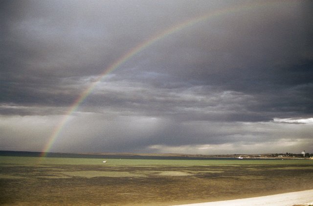 Rainbow at Streaky Bay, SA. This was the view from our top-class
"apartment" at the Streaky Bay Foreshore Tourist Park -
right on the beach!
Rainbow at Streaky Bay, SA. This was the view from our top-class
"apartment" at the Streaky Bay Foreshore Tourist Park -
right on the beach!
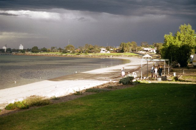 Another view of Streaky Bay beach, SA, from Tourist Park. Note
the Pelicans being fed (or wanting to be fed), and the storm
activity in the background.
Another view of Streaky Bay beach, SA, from Tourist Park. Note
the Pelicans being fed (or wanting to be fed), and the storm
activity in the background.
 Lightning from Streaky Bay beach, SA. This was a 5 minute
exposure.
Lightning from Streaky Bay beach, SA. This was a 5 minute
exposure.
 Murphys Haystacks - unusual rock formations between Streaky Bay
and Port Lincoln, on the western side of Eyre Peninsula, SA.
Murphys Haystacks - unusual rock formations between Streaky Bay
and Port Lincoln, on the western side of Eyre Peninsula, SA.
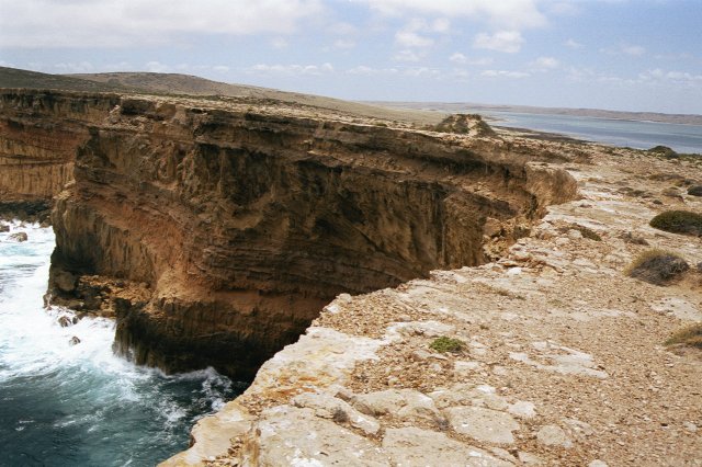 Sea cliffs near Lake Hamilton (the Lake's visible at the right of
picture), again between Streaky Bay and Port Lincoln, on the
western side of Eyre Peninsula, SA.
Sea cliffs near Lake Hamilton (the Lake's visible at the right of
picture), again between Streaky Bay and Port Lincoln, on the
western side of Eyre Peninsula, SA.
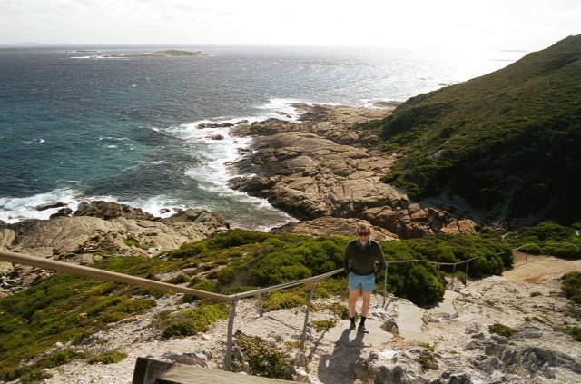
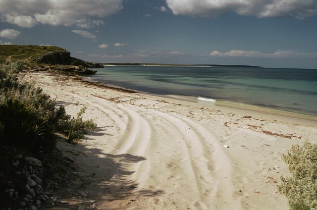 A pleasant beach (Taylors Landing) in Lincoln National Park, near
the southern tip of Eyre Peninsula, SA. We saw our first live
snake in the wild near here - almost squashed it - car wheels
either side!
A pleasant beach (Taylors Landing) in Lincoln National Park, near
the southern tip of Eyre Peninsula, SA. We saw our first live
snake in the wild near here - almost squashed it - car wheels
either side!
 Back to city life - Flinders Street Railway
Station in Melbourne. After returning the rental car in Adelaide
we got the train to Melbourne - a 10 hour day trip on "The
Ghan".
Back to city life - Flinders Street Railway
Station in Melbourne. After returning the rental car in Adelaide
we got the train to Melbourne - a 10 hour day trip on "The
Ghan".
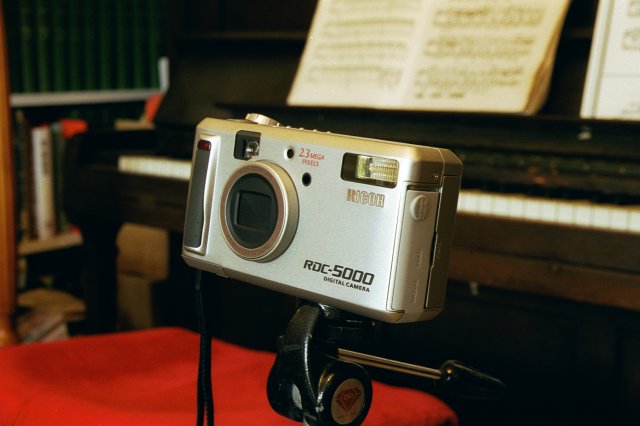 I splashed-out in Melbourne and bought myself a new digital
camera - and this is it!
I splashed-out in Melbourne and bought myself a new digital
camera - and this is it!